Getting Under Way
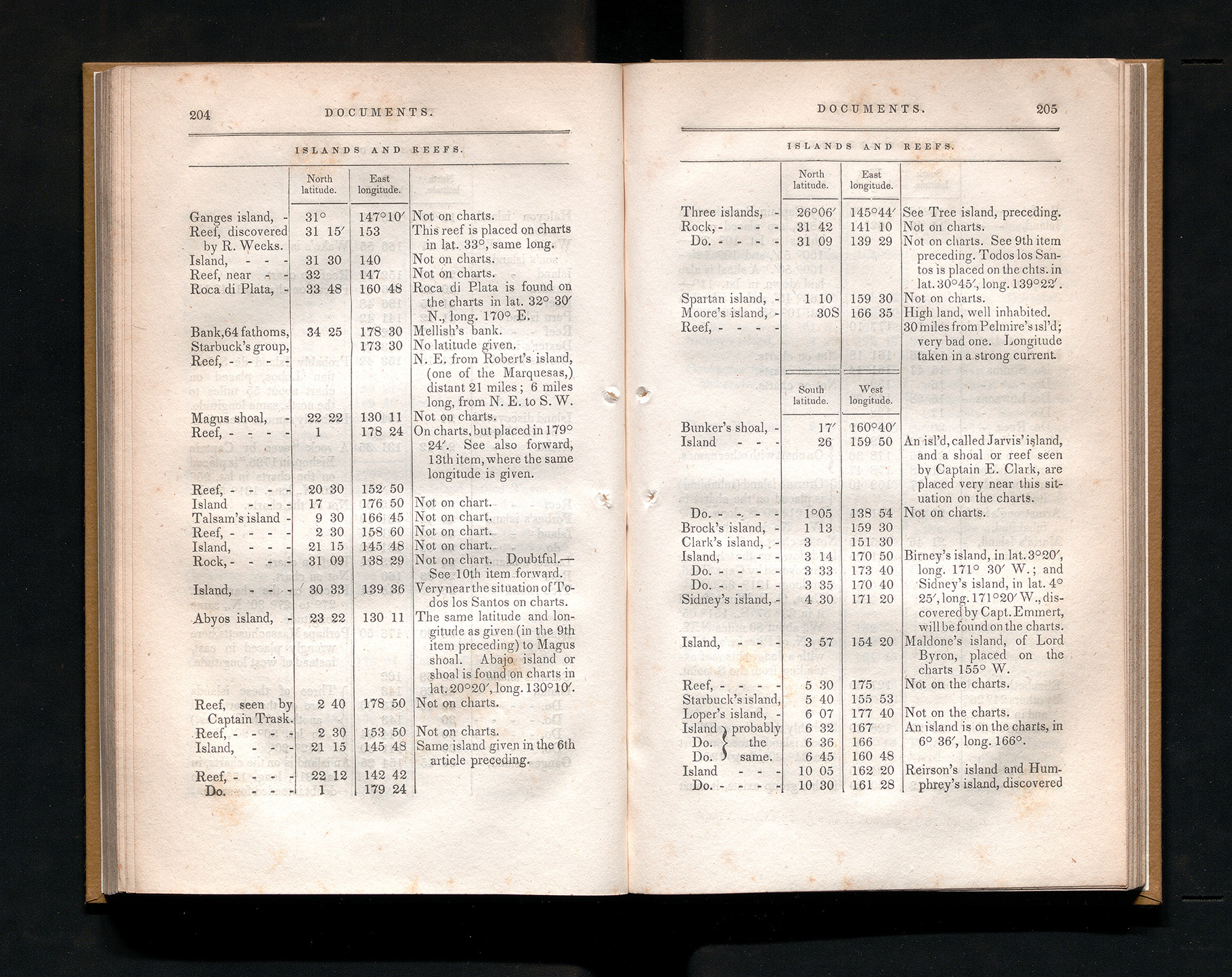
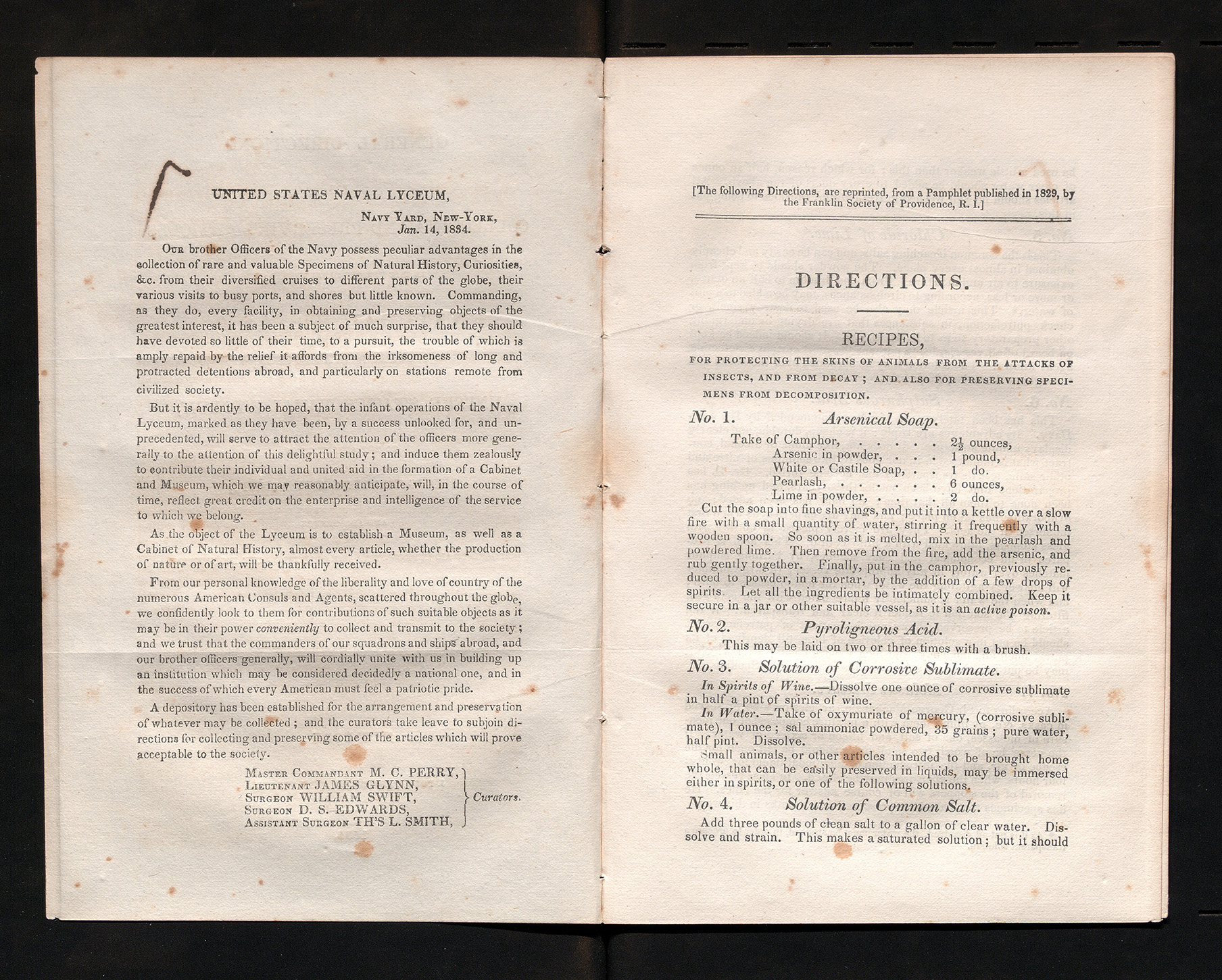
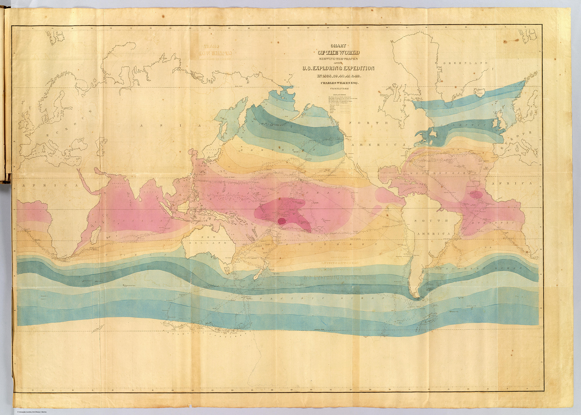
In the 1830s, the oceanic charts available to mariners were dangerously incomplete. Rocks, shoals, and reefs would regularly destroy ships, despite efforts by navies and commercial mariners to record and share the dangers they encountered. After many mishaps led to the loss of lives as well as cargoes, Congress commissioned the United States Exploring Expedition. Lieutenant Charles Wilkes, with little command experience, was placed at its head.
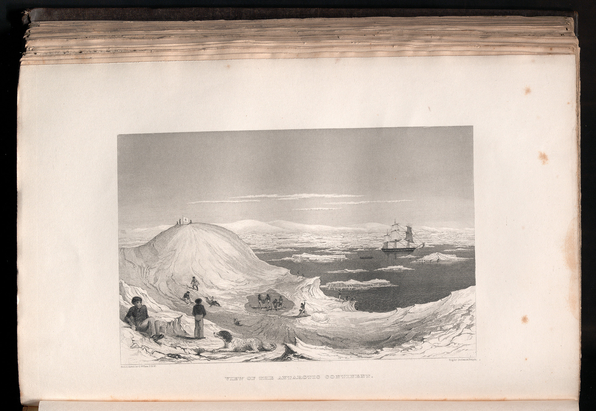
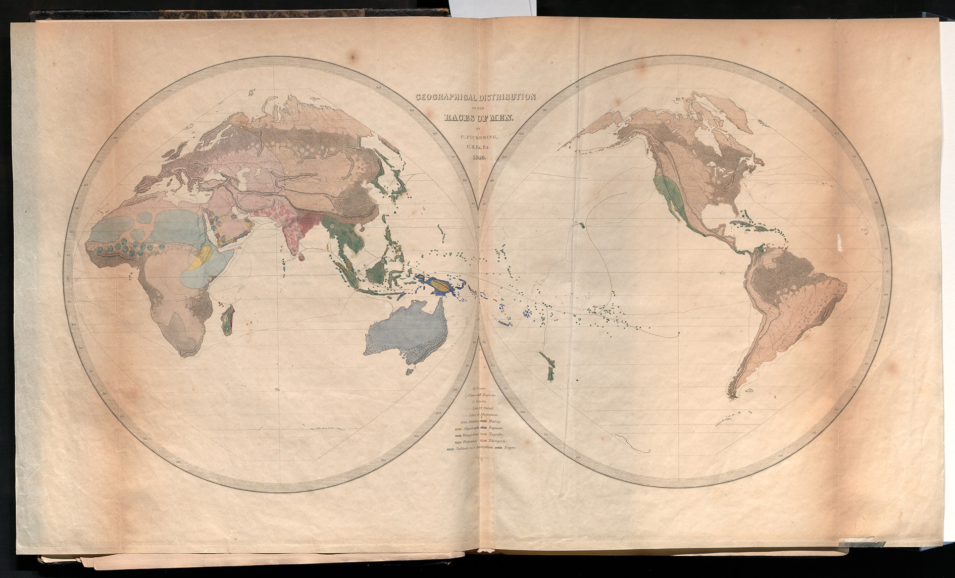
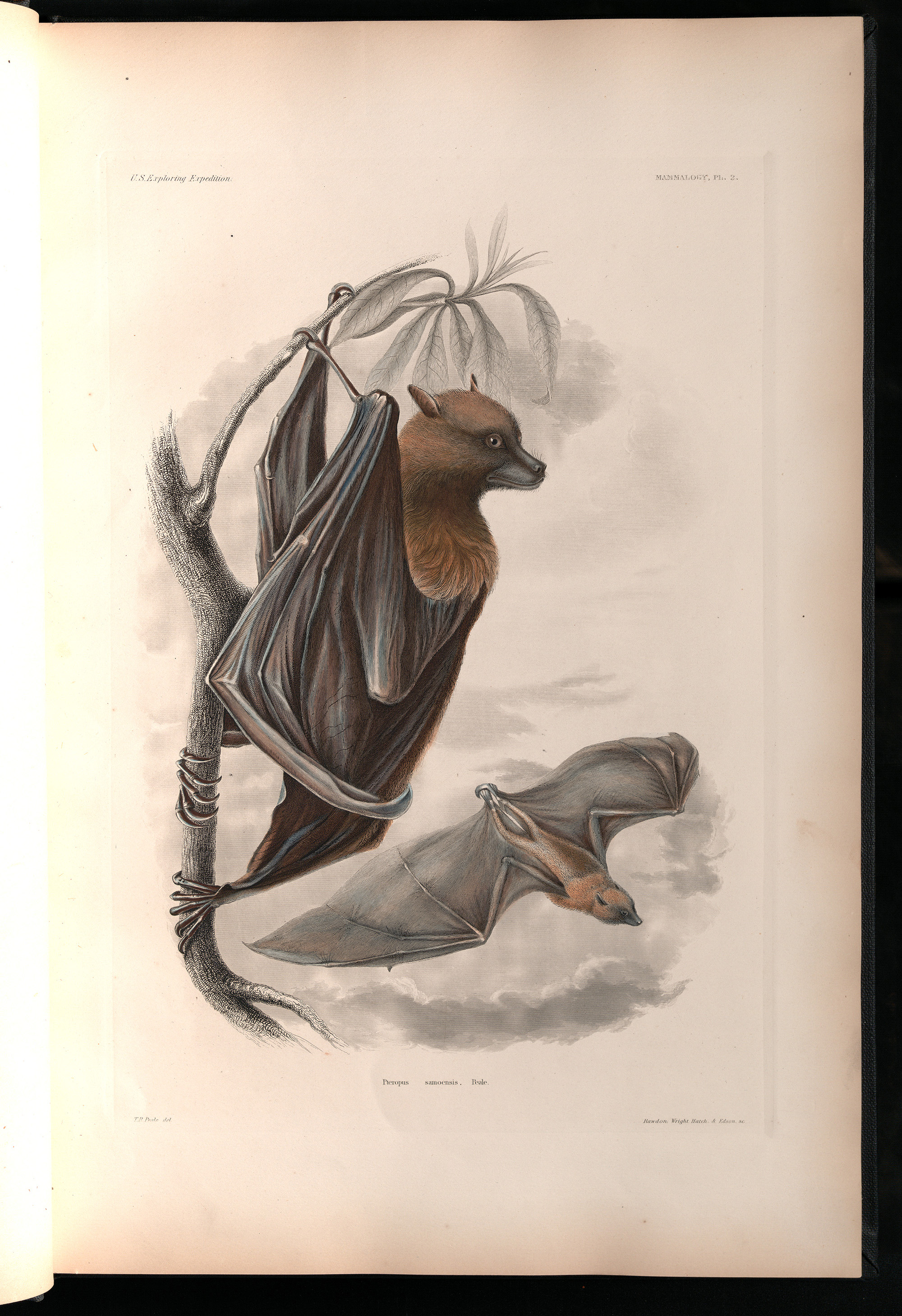
The Wilkes Expedition (often called the “Ex. Ex.”) would return with thousands of artifacts and specimens, forming the nucleus of what would become the Smithsonian Institution. It also led to the creation of 241 charts that would map over 2,000 miles of coastline and identify 280 Pacific islands. The results of this expedition dwarfed any that had been conducted by a European power to this point, and added much to the argument for American exceptionalism.